
News Summary
Las Vegas is gearing up for an unprecedented five-day thunderstorm forecast as the National Weather Service issues First Alert Weather Days. Severe thunderstorm warnings and flash flood alerts have been declared, with high rainfall chances expected. Residents are urged to prepare for severe weather including flash floods, strong winds, and power outages. The region has not seen significant rainfall in months, making this weather event particularly noteworthy. As temperatures soar, the region braces for potential disruptions to daily life due to this extreme weather pattern.
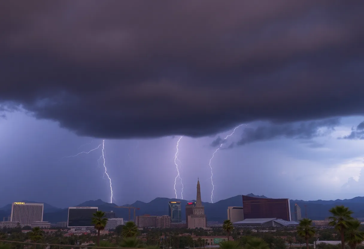
Las Vegas Braces for Unprecedented Five-Day Thunderstorm Forecast Amid Extreme Weather Alerts
Las Vegas residents are preparing for a significant weather event, as thunderstorms are expected to hit the region for five consecutive days starting today. The National Weather Service has declared First Alert Weather Days from Monday to Wednesday, indicating heightened shower and thunderstorm activity in the Las Vegas Valley.
Severe thunderstorm warnings have been issued for central Clark County, which includes areas such as Indian Springs. In addition, a flash flood warning is in effect for parts of northwestern Clark County until 4:15 PM today, signaling that the risk of flash flooding is high.
The Las Vegas Valley has not experienced significant rainfall since mid-July, but that is about to change, starting today. A 70% chance of rain is predicted for the valley, with an even higher 80% chance forecast for the nearby mountains. Today’s high temperature is expected to be around 95°F, with isolated thunderstorms potentially developing in the afternoon.
As the week progresses, high temperatures are forecasted to reach around 98°F on Monday and 94°F on Wednesday. Storm development is anticipated primarily between noon and 7 PM, especially during the afternoons, when meteorologists expect the most intense storm activity.
Residents are advised to be cautious, as meteorologists warn of severe weather potential, including flash flooding, frequent lightning, strong winds, and small hail. Local emergency management agencies have begun coordinating resources in anticipation of the storm’s impacts, such as flooding and power outages. Residents should take this time to prepare by maintaining emergency supplies, closely monitoring weather updates, and ensuring their vehicles are in safe condition for travel.
The weather pattern this week indicates a substantial increase in storm activity, with the most intense conditions expected on Tuesday afternoon and evening. Historical rain events for the Las Vegas area show that the last measurable rain was recorded on May 6, totaling 2.05 inches for the year, which is below the average rainfall of 2.27 inches.
This unusual setup in the desert region’s typically dry climate has created an atmosphere conducive to repeated thunderstorm development. Furthermore, extreme heat warnings have been in effect, with daily temperatures averaging 5 to 10 degrees above normal for several days leading up to this event.
As thunderstorms can develop rapidly in the desert, residents are urged to prepare for swift changes in weather conditions. Local transportation departments and utility companies are also on alert for possible disruptions due to flooding and power outages.
The forecast is continually evolving, with potential storm activity expected to extend through Friday. This could significantly affect daily routines and travel plans across the region, emphasizing the importance of staying informed and prepared. Residents are encouraged to seek shelter during thunderstorms to mitigate risks associated with lightning and strong winds.
As the storms approach, Las Vegas is bracing itself to confront an unprecedented weather event that promises to transform its typical desert landscape into a scene of intense storm activity.
Deeper Dive: News & Info About This Topic
HERE Resources
Las Vegas Valley Braces for Thunderstorms After Heat Wave
Las Vegas Faces Extreme Heat Warning with High Risks
Las Vegas Issues Extreme Heat Warning Amid Thunderstorm Predictions
Las Vegas Faces Extreme Heat Warning as Summer Temperatures Soar
Las Vegas Monsoon Season Starts Off Underwhelming
Residents Push for Safety Enhancements at Hazardous East Las Vegas Crosswalk
KAYZO to Headline UNLEASHED 25 in Las Vegas
Las Vegas Braces for Intense Heat and Possible Thunderstorms
Las Vegas Prepares for Extreme Heat and Monsoon Moisture
Las Vegas Braces for Monsoon Season and Extreme Heat
Additional Resources
- Las Vegas Review-Journal
- Wikipedia: Monsoon
- Fox 5 Vegas
- Google Search: Las Vegas weather alerts
- News 3 LV